Description
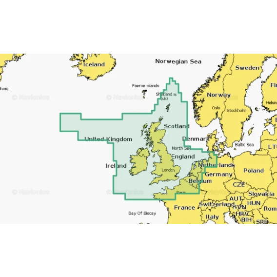
Detailed coverage of the UK, Ireland, and the North Sea and English Channel coasts. Coverage includes the Shetland Islands, Orkney Islands, Isle of Man, Isle of Wight, the Isles of Scilly, the Channel Islands, the Thames River, the IJsselmeer, the Waddenzee, and the Kiel Canal. Ports include London, Liverpool, Southampton, Edinburgh, and Belfast, UK; Dublin and Cork, Ireland; Brest, Le Havre, Calais, and Dunkirk, France; Antwerp, Belgium; Amsterdam and Rotterdam, The Netherlands; Bremerhaven, Hamburg, and Kiel, Germany.
Card type: SD/MSD
| Navionics+ | Platinum+ | |
|---|---|---|
| Coastal Content | • | • |
| Inland Content | 42,000+ lakes |
42,000+ lakes |
| Detailed Nautical Charts | • | • |
| Daily Updates1 | • | • |
| Dock-to-dock Route Guidance 1,2 | • | • |
| Plotter Sync1 | • | • |
| Community Edits | • | • |
| Advanced Map Options1 | • | • |
| SonarChartTM Live Mapping3 | • | • |
| Relief Shading1 | Via Chart Installer | |
| Satellite Imagery with SonarChartTM Shading Overlay1 | Via Chart Installer | |
| Aerial Photography | • | |
| 3D View | • |


Reviews
There are no reviews yet.